Most people associate the term GPS with navigating unfamiliar areas or locating missing devices. But to those of us in the construction industry, GPS also acts as a tech-savvy tool we can use to enhance a building project.
In recent years, forward-thinking leaders in the construction space have been churning out innovative GPS-enabled tech to transform the way we excavate and build. In the excavating and land-development world, GPS-enabled construction equipment gives excavators an undeniable edge. From increasing accuracy to improving efficiency, here’s how tech-savvy excavators are making your projects better.
The Traditional Way to Survey Land
Before GPS-enabled heavy construction equipment, people would survey the site with grading stakes. The information they collected was essential, as it brought to light exactly how much cutting and filling was needed. Then, the surveyor would communicate the conditions to the team, and sometimes lasers were used to show the required level of earth. The equipment operators would then adjust the land until the surveyor confirmed the correct grade was achieved.
While this was and still is an effective method, it requires crew members to stand by grading stakes as large construction equipment operated around them. Now, there’s a safer and more efficient method.
GPS in Sitework Estimating and Preconstruction
“We have the capabilities to do in-field as-built surveys prior to bidding a job. This can help us have a better understanding of the project site prior to submitting our bid,” shares Matt Peifer, Superintendent with Horst Excavating.
“Once the project is awarded, we’ll create a 3D model based on the CAD drawings. This model is uploaded to our rover, which is used to localize the project site,” shares Peifer. This information helps check grades, complete as-built surveys for utilities, calculate volumes, and assist with the coordination of 3D-machine-controlled equipment.
Once the project is awarded and work begins, construction equipment that’s equipped with the right technology uses these digital models to make their work faster and more accurate.
To learn more about Horst Excavating’s preconstruction process, check out this blog.
Using GPS to Survey Land
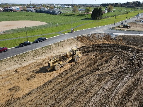
As technology improves and becomes more affordable, sitework contractors are turning to GPS to help survey and grade earth while on site.
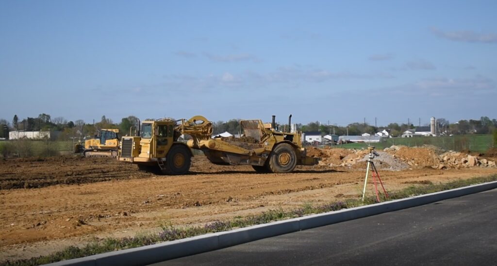
This technology uses GPS to detect the precise grade of the land that’s being worked. Unlike with the traditional grading stakes method, this information is often right at the equipment operators’ fingertips with a small monitor located inside the operator cabin. It’s also updated in real time, so operators can see where and how much earth needs to be moved.
Newer dozers, excavators, graders, and other equipment often have a GPS grading system with a display in the operator’s cabin built in. Older equipment can be retrofitted to include the new technology.
In addition to the screen that shows the grading of the land, the equipment’s blade can also be equipped with GPS. With this technology, the GPS reader senses the earth below and drops the blade down to the precise level of the final grade.
The Benefits of GPS During Sitework
Purchasing and retrofitting equipment with GPS does come at a higher cost. However, that cost is made up for and then some with the many benefits it offers.
“This saves us on time, fuel costs, equipment wear and tear, and helps us stay on schedule and on budget,” Peifer shares.
Perfectly level earth is essential to many roads, parking lots, warehouses, and manufacturing facility floors, athletic fields, and more. GPS-enabled equipment in the hands of experienced earth movers is the best way to achieve the precision required.
But it’s more than just getting something perfectly flat. Building sites of all kinds have specific slopes and elevations that need to be precisely graded, and GPS-enabled equipment makes a precise result much easier.
Secondly, GPS helps save time and labor. With screens showing the surveyed land in real time, operators can efficiently approach and complete their portion of the project. By ensuring a more accurate result the first time, rework often isn’t needed. It also frees up those who would be doing the land surveying for other work. By working faster and more efficiently, crews will save on fuel costs as well. And with today’s precarious gas prices, that’s a huge benefit.
Technology, Equipment, & Talent
Having the right technology and the right equipment certainly improves the quality of work you can expect on your land development project. But when it comes down to it, it’s the people who are operating and implementing the machines that determine the outcome of your project.
From the early planning and preconstruction stages to the last bit of dirt put in place, you’ll need a crew of experienced, hard-working professionals. At Horst Excavating, we’ve assembled and trained a team that’s the best of the best. And by drawing on our large bench of internally owned construction equipment, you can rest assured we have what it takes to get your excavating project done the right way.